Table of Contents
The Lemosho route trekking substitutes the traditional Shira route through the Shira Plateau. Hikers still use that track infrequently, the Lemosho route is more commonly chosen by those seeking to cross the Shira Plateau on their way to the summit of Uhuru Peak despite the fact that it is sometimes known as the Shira Route.
The Lemosho route accesses the Kilimanjaro mountain from the west, passing through rainforests preferred by elephants as a migratory route (thus the more open canopy than in the south), and joins the Machame route at the bottom of Kibo near the Lava Tower on the fourth day. The minimal hiking time is 7 days, with 8 days being preferable due to best acclimatization.
The Shira or Lemosho routes, which were once only used by high-end travel agencies, are now included in most trekking operators’ sites, though they’re still not as popular as the Machame and Marangu routes.
Day 1: Londorossi Gate to Mti Mkubwa
The journey to the Londorossi Gate from either Arusha or Moshi can belong about 3 to 4 hours from Moshi, significantly longer from Arusha. While reaching the entrance gate and after registering and having all of your bags and equipment weighed, you will rejoin your vehicle to ascend Kilimanjaro’s lower foothills where the hike will start. At around 2000m, the trek starts in the lower sections of the rainforest, where a family of colobus monkeys appears to have made themselves at home.
The very first day’s trek is only a couple of hours long (about 6km) and takes you through one of the nicest tracts of rainforest on the Kilimanjaro mountain, a vast expanse of unspoiled nature where elephants used to roam and leopards hunt at night. On this first day, the Mti Mkubwa (“Big Tree”) Campsite (2650m) is the objective, which is nicely situated in the shadow of a huge podocarpus tree.
day 2: mti mkubwa to shira 1 campsite
The next day takes you out of the forest and uphill towards the Shira Ridge, covering a distance of roughly 7 kilometers. The southwestern edge of the ancient Shira Crater, generated by the first volcano eruption, was this peak (Shira peak).
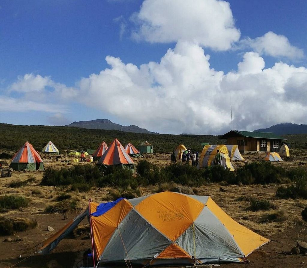
After crossing heath and moorland, you’ll arrive at the top of the cliff (3610m) in about 5—6 hours, with spectacular scenery of the Kibo peak. You’ll reach Shira 1 (3480m), and spend your night here, just 20 minutes after descending off the hill onto the Shira Plateau, near one of the many streams that transverse the plateau.
Day 3: Shira 1 Campsite to Shira 2 Campsite
The 3rd day of this hike is a relatively short and fairly simple hike across the Shira Plateau, though some of the experienced trekking operators vary the route by going south to Shira Cathedral.
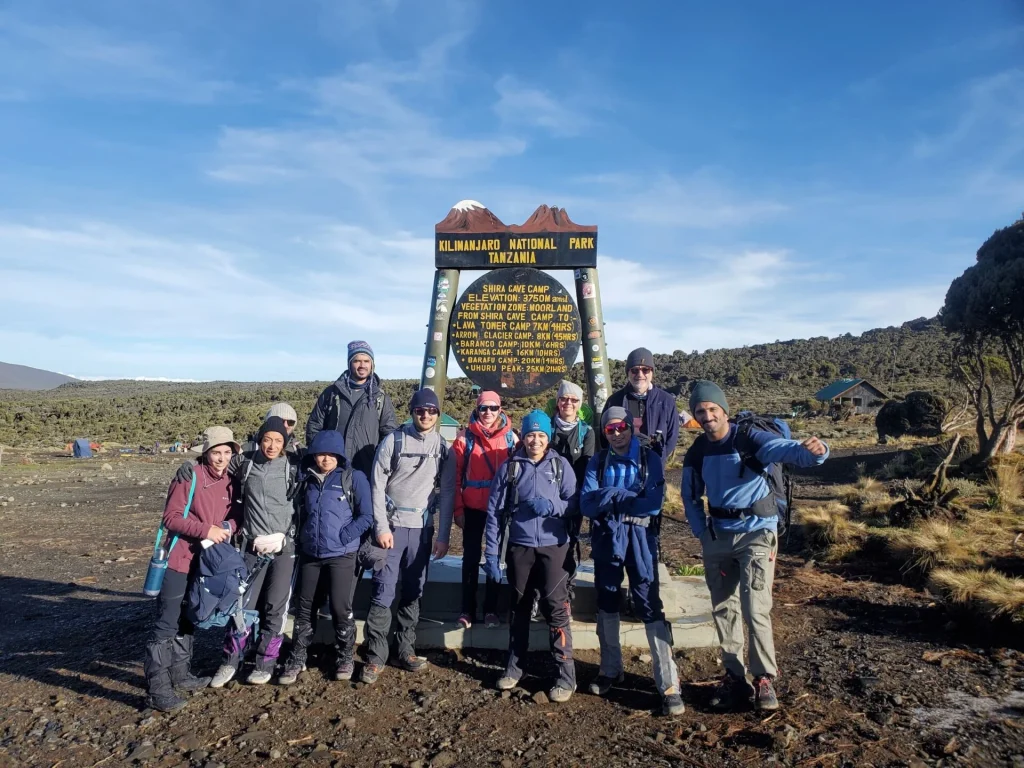
This down ridge (3720m) on the southwestern edge of the plateau provides excellent views of the Machame Route on the mountain’s southern side. Whatever way you select, you’ll arrive at Shira Huts (also known as Shira 2, 3840m), a spacious and well-equipped campground in the midst of the plateau surrounded by crisp white flowers at the end day.
Day 4: Shira 2 Campsite to Barranco camp
Today’s route is approximately 9 kilometers long and runs almost straight east across the plateau to the Kibo peak and a junction with the Machame route near the Lava Tower. If the skies are clear, this is a fantastic day for photography because the light at this level is really beautiful, and the Kibo summit is especially stunning (and imposing) from this vantage point.
The trek to Lava Tower (4610m), where most trekkers eat lunch, is persistently upward but never difficult. If you’re not following the Western Breach route, your route will curve around Kibo’s southwestern side before dropping to Barranco Huts Campsite (3895m).
Day 5 and 6: Barranco Camp to Barafu Camp
Although the trail from Barranco to Barafu Camp is described as a 1-day hike but it is usually done in 2 to 4 hours portions, with an overnight stop at the Karanga campsite in the between. This is extremely crucial if you didn’t spend a day at the Shira campsite for the best acclimatization.
Only a few sections of the Barranco Wall need hands-and-feet climbing, despite its steepness. Because the trail is limited, “seasoned” climbers may become irritated by the slow pace; ignore them and go at your own leisure. The trek takes about 90 minutes, and you’ll be rewarded with a wonderful view of the Heim, Kersten, and Decken glaciers at the top.
The trail then makes a beautiful eastward journey around Kibo’s base. By lunchtime, you should be at the top of the freezing Karanga Valley (4130m), allowing you a lovely evening to relax and sleep before moving out to Barafu the next day.
Heading eastward from Karanga Valley, the route eventually reaches a junction with the Northern circuit route after about 2 hours. Turn left for Barafu Camp, which is a 90 minutes ascent up a steep, rocky lava ridge.
It frequently snowfalls, and during the rainy season, this area might get completely engulfed.
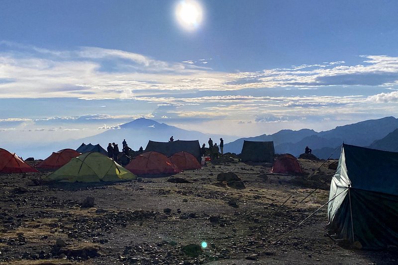
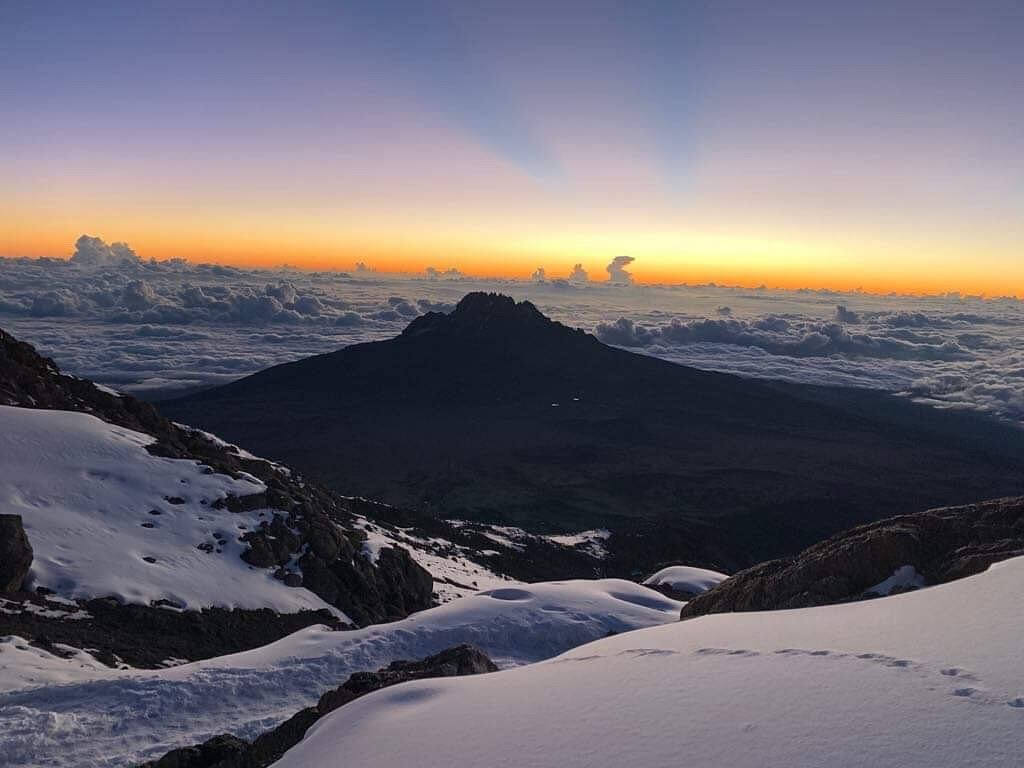
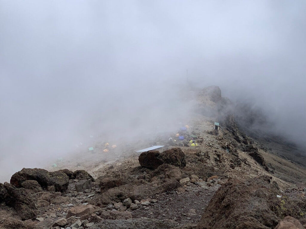
Barafu Camp (4681m) is located on a ridge on the Saddle’s southern border, with a spectacular view of Mawenzi Peak. The disadvantage is that the campsite is frequently unclean; bring your trash down with you. The long drops are close to the ridge edge, so be cautious at night. Go to bed as soon as the sunset.
Days 7 and 8: Barafu to the summit and back down
The most exhausting day is a summit day, which requires trekking from Barafu Camp to the roof of Africa, Uhuru Peak (6–8 hours) and then descending to Horombo Hut on the Marangu route and Rongai Route or Mweka Camp on the Lemosho route.
The “session” begins when you are awakened for breakfast before midnight, and most hikers depart between midnight and 1 am. The trail ascends a steep valley on the outskirts of scree fields before passing between the Rebmann and Ratzel glaciers to Stella Point (5672m) on Kibo’s southern rim; the final few hundred meters are the most difficult part of the ascent. The ice-covered trail to Uhuru Peak (5895m) is about an hour longer; see 5 Days via the Marangu route for further information.
The Last Day on the Mountain
The path is rocky in most sections, with incredibly loose debris, making progress excruciatingly slow. On the way back down, most visitors arrive at Barafu Camp between 9 and 11 a.m., where they rest for an hour before embarking on a long journey down, either by the Mweka or Marangu paths, for their final night on the mountain.
Day 8 consists primarily of a few miles of reasonably easy, albeit occasionally muddy, downhill trekking. Take things slowly. You can always contact Kilimanjaro ASAP or Safari ASAP expert for more advice on Lemosho Route trekking details. We would love to arrange your Lemosho route trek for you.
Frequently Asked Questions
What makes the Lemosho Route special compared to other Kilimanjaro routes?
The Lemosho Route is widely considered one of the most scenic ways to climb Mount Kilimanjaro. It starts on the western side of the mountain, offering quiet trails and fewer crowds in the early days. Trekkers pass through diverse landscapes, from lush rainforest to dramatic alpine deserts. The route also joins the Machame Route later, giving a perfect mix of solitude and classic Kilimanjaro views. Many people love it because it feels more like a true wilderness adventure from start to finish.
How many days does it take to complete the Lemosho Route?
The Lemosho Route typically takes 7 to 8 days to complete, which gives trekkers a better chance to acclimatize. This longer duration is one of its biggest advantages, as it allows your body to adjust gradually to the altitude. Most itineraries include a slow climb with a “climb high, sleep low” approach. Camps are set in beautiful locations like Shira Plateau and Barranco Valley. Taking the extra days seriously increases your chances of reaching Uhuru Peak successfully.
Is the Lemosho Route suitable for beginners?
Yes, the Lemosho Route is actually one of the best choices for beginners who are reasonably fit. While it’s not the shortest route, its gradual ascent makes it more manageable than steeper options. The extra acclimatization time helps reduce the risk of altitude sickness. However, it still requires good physical preparation, including hiking practice and endurance training. With the right mindset and a steady pace, many first, time climbers successfully summit via this route.
What kind of accommodation is provided on the Lemosho Route?
Unlike the Marangu Route, the Lemosho Route is a full camping experience. Trekkers sleep in tents set up by guides and porters at designated campsites along the trail. Dining tents and basic camping facilities are usually provided, depending on your tour operator. While it’s less “comfortable” than hut routes, many people find it more adventurous and immersive. Falling asleep under the stars on the slopes of Mount Kilimanjaro is something you won’t forget.
When is the best time to hike the Lemosho Route?
The best time to trek the Lemosho Route is during the dry seasons, from January to mid, March and June to October. These months offer clearer skies, better trail conditions, and more reliable weather. The views from places like Lava Tower and the summit are often spectacular during these periods. Rainy seasons can make the trail muddy and reduce visibility, especially in the rainforest zone. Planning your climb in the dry months gives you the best balance of safety, comfort, and unforgettable scenery.
Still have questions?
Our local safari experts are happy to help you plan the perfect African safari.