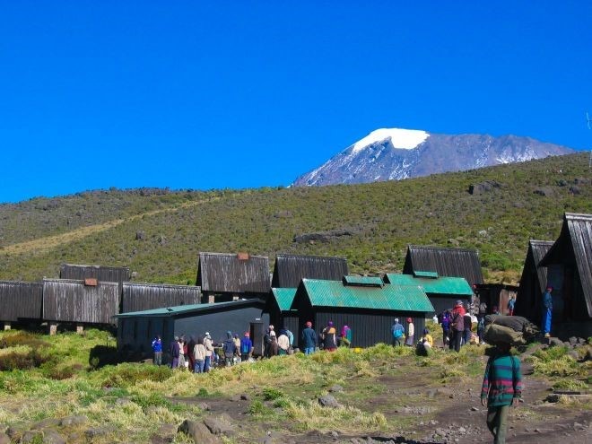
A spectacular Rain Forest Trail to the summit area is the Shira Route. Shira translates from native Swahili as sail, and it is quite possible that that is exactly what individuals who elect to summit Kilimanjaro via the western Shira Route will in fact do. Apart from being incredibly beautiful, this trail up the mountain also has the added advantage of taking longer than most other routes, thus allowing for better Acclimatisation from start to finish.
Typically the Shira Route follows a similar itinerary to the Machame Route, with the exception of a different starting point and a couple of extra days on the mountain to enjoy the spectacular surroundings. Climbers will transfer to the Shira Gate in the Kilimanjaro National Park, after which they will begin their expedition up the winding trail through the flourishing rainforest at the base of the mountain. After approximately 5 hours of hiking, the forest will gradually begin to thin, eventually transforming into moorland dotted with giant heather. It is here that the first overnight camp, Shira Forest Camp is situated.
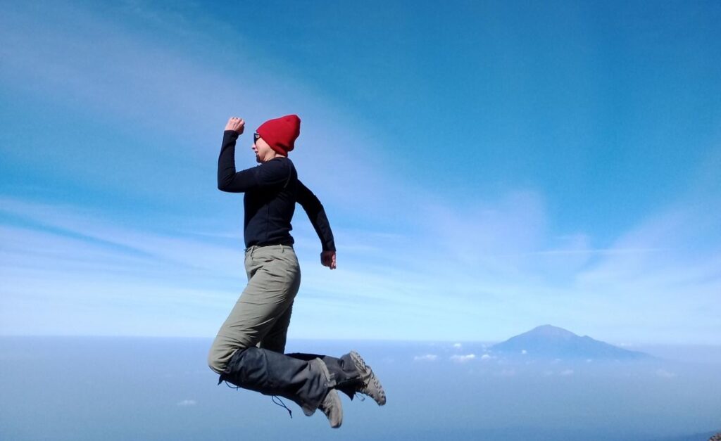
The following day, hikers will set off towards the Shira plateau. Subsequent to ascending up a sheer rim, climbers will be able to view all three peaks of Kilimanjaro- Shira, Kibo and Mawenzi.On an incredibly clear day one may also be lucky enough to make out the outline of the third highest peak in Africa, Mount Meru, situated just to the west. After trekking north for a further couple of hours, the trail will take a turn to the west up a river gorge, after which the landscape becomes gradually more desolate. The second campsite, Shira Camp, is situated on the Shira Plateau at an altitude of around 3800 meters. From here, climbers can take in the setting sun as it fades behind the three pinnacles of the Shira Ridge.
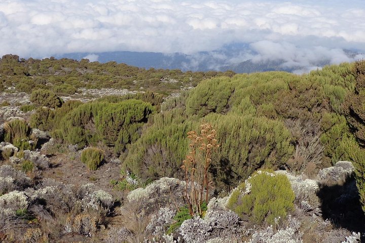
An early start on day three sees hikers journeying through an extensive basin, before heading south towards the unique Lava Tower. The trail then winds steeply downwards towards the Great Barranco Valley. Barranco Camp is located at an altitude of roughly 3900 meters, and is positioned so as to provide breathtaking views of the Western Breach looming directly above it. Climbers will enjoy an early dinner and well deserved nights rest here before setting off for the penultimate campsite in the Karanga Valley.
As an Alternate Route, Shira tends to become windier and more difficult to follow during its second stages. The toughest leg of the journey to Karanga Camp is the taxing climb up the sheer Barranco Wall. Although appearing incredibly ominous, most climbers find the scramble far less difficult than it initially appears. After conquering the Wall, hikers will follow the trail along the southeastern edge of Kibo towards Decken, Kersten and Heim, the strangely Germanic sounding southern icefields. From here, the path winds sharply downwards into the Karanga Valley, where Karanga Camp is situated approximately 4000m above sea level.
The following morning, after refilling all water supplies for the rest of the expedition, walkers will begin their climb to Barafu Camp which lies at around 4600 meters. As climbers ascend, they will quickly notice the manner in Fauna and Flora disappear, and the surrounding landscape becomes more and more hostile. Situated on a barren outcrop of mountain, Barafu Camp appears almost to exist on a desolate planet all of its own. Climbers should endeavour to ensure that they familiarise themselves with the harsh surroundings before sunset, so as to avoid injuring themselves on the rocky terrain after darkness falls.
At around 1am the next day, climbers will begin their summit attempt. Up until this point the Shira Trail will have been less taxing than the majority of other routes, but when it comes to the final stretch each and every individual is pressed to their limits and beyond. ‘Pole pole’ is the only approach to adopt, as every breath feels as though it may possibly be one’s last.
For many hopefuls, their summit attempt will end at Stella Point due to both physical exhaustion and the effects of altitude. By contrast, those who succeed in making the final push on to Uhuru Peak are likely to forget all about their aching bones and freezing fingers. Gazing down at the Beautiful Continent spread like a quilt below them, it is quite possible that for a brief moment they truly will feel as if they are perched not only on the top of Africa, but in fact on top of the entire world!
Frequently Asked Questions
Why is the Shira Route considered one of the most beautiful routes on Kilimanjaro?
The Shira Route is often described as one of the most beautiful ways to climb Mount Kilimanjaro because of its wide, open landscapes and dramatic views. It begins on the Shira Plateau, which offers stunning scenery right from the start. Trekkers enjoy sweeping vistas, unique vegetation, and a sense of space that is hard to find on other routes. The sunsets and sunrises along this route are especially unforgettable. Its natural beauty makes the journey just as rewarding as reaching the summit.
How does the Shira Route differ from the Lemosho Route?
The Shira Route and Lemosho Route eventually join, but they start in different places. Shira begins at a higher altitude, which means you skip the lower rainforest section. Because of this, acclimatization can be more challenging for some trekkers. Lemosho, on the other hand, starts lower and allows a more gradual adjustment to altitude. Despite this difference, both routes share similar scenery after the first few days. Many people choose between them based on their experience and acclimatization preference.
Is the Shira Route suitable for beginners?
The Shira Route is generally not recommended for complete beginners because it starts at a high elevation. This rapid gain in altitude can increase the risk of altitude sickness early in the trek. Trekkers need to be well, prepared and ideally have some previous high, altitude experience. However, with proper planning and a longer itinerary, some beginners can still succeed. It is important to go slowly and listen to your body throughout the climb.
What kind of scenery can you expect on the Shira Route?
The scenery on the Shira Route is incredibly diverse and visually striking. You begin on a high plateau with open moorland and unique volcanic features. As you continue, you pass through alpine desert zones with dramatic rock formations. The route also offers amazing views of Kibo Peak and the surrounding plains. Because it is less crowded, you can enjoy these landscapes in a peaceful setting.
How many days does it take to complete the Shira Route?
Most Shira Route climbs take around six to eight days, depending on the itinerary. A longer trek is usually recommended to help with acclimatization and improve your chances of reaching the summit. The route merges with others, so the later days follow similar paths to Machame or Lemosho. Even though the starting point is higher, the overall pace still allows for a steady climb. Choosing the right number of days can make a big difference in your overall experience.
Still have questions?
Our local safari experts are happy to help you plan the perfect African safari.